
In General
Milepost Pictures
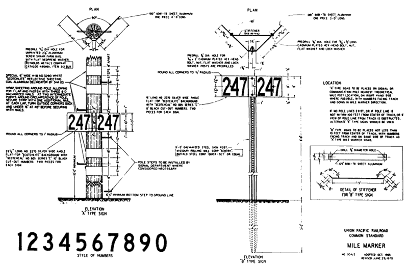
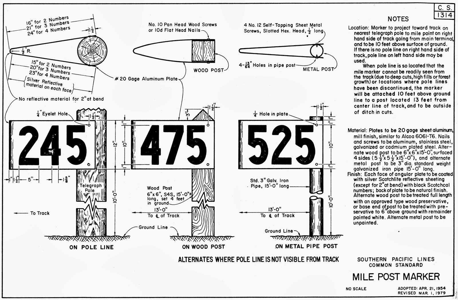
Drawings
Whistle Posts
Floobydust
RAILFAN GUIDES HOME
RAILROAD SIGNALS HOME
The Scoop:
Rather than re-invent the wheel, I borrowed this accounting of mileposts found here
Deciphering mile posts along the tracks
Guest post by Richard C. Carpenter:
When we drive along the interstate highway system, we measure our progress by mile markers, which are placed just off the right shoulder of the roadway. Interstate standards require that they be measured from zero at the state line and run to the next state line—west to east and south to north.
Railroads have long had their mile markers, too. They are called mile posts. These mile posts are the geographical measure of a railroad line. Their zero mile post locations and their end points often tell us something about the history of the line. Mile posts allow train crews to determine their exact location along otherwise nondescript stretches of geography.
They are also referenced when numbering bridges, and used to define the limits of speed restrictions.
Each railroad has its own style of mile post and its own way of numbering mile posts. Several railroads use their mile posts to measure every main and branch line from one zero location. For the Southern Pacific, mile post zero is San Francisco, 3rd and Townsend Streets. In the case of the Seaboard Air Line, zero is Richmond, Virginia. The Lehigh Valley (LV) mile posts start at the ferry slip on the New York side of the Hudson River, across from their Jersey City terminal station. On the LV posts, the mile number is cut in a metal diamond at the top of a thin pipe, then painted black.
Here are some specific examples, by railroad, of mile post styles and their start and end points.
The New York Central mile posts were stone or concrete, in the shape of a headstone. Some were unpainted, with a letter or letters for the origin point (ex.: “NY” for New York City) and the mileage cast in the concrete. Others were painted white with black letters and numbers. The original main line ran between New York City and Buffalo, New York, and were measured from zero at Grand Central Terminal in New York City to mile post 439 at Buffalo. The letters “NY” stood above the mileage numerals.
In 1914, the New York Central merged the Lake Shore and Michigan Southern into its system. The Lake Shore’s mile posts started at Buffalo and ended at mile post 540 at La Salle Street Station in Chicago. The letter “B” signified the zero point at the train’s Exchange Street Station in Buffalo. Originally, the mile post mileage west of Elyria, Ohio, was via the original LSMS line through Bellevue to Millbury, Ohio. West of Air Line Junction, in Toledo, the original milepost mileage ran through Sturgis, Michigan to Elkhart, Indiana.
This resulted in a total mile post mileage of 540 miles, as indicated above. These two segments were later referred to as the “Old Road,” to distinguish them from the Sandusky main line and the “Air Line” main line, both of which were built later. Sometime after 1946, the New York Central changed the mile post numbering west of Elyria Junction, Ohio via Sandusky and via the “Air Line” west of Toledo to be from Buffalo, so as to create a unified mile post series.
This resulted in a mile post mileage 18 miles shorter a than the original LSMS mile post mileage!
The Pennsylvania Railroad used a cast metal mile post, with a sloped top facing the track, and sides angled so the the cast number on each side would be visible from both directions. The bottom was slightly wider than the top. The mile post was painted white, with the mile numbers painted black. These mileposts were cast in the foundry of the PRR system shops in Altoona, PA
The original PRR main line started with the zero milepost at Broad Street Station, Philadelphia, and ran via Harrisburg and Altoona to mile post 353 at Pittsburgh. West of Pittsburgh, the mileposts ran from zero at Pittsburgh to mile post 467, south of Union Station, Chicago.
This latter line was originally the Pittsburgh, Fort Wayne and Chicago, which became part of the PRR in 1869.
Acknowledgements:
Cosmos Mariner
Don Morgan
Florida RR Museum
Gerald Oliveto
Nick Kudrako
Otto Vondrak
Rich McPeek
Richard C.
Steve Sloan
www.trainweb.org/oldmainline
Wikipedia
Websites and other additional information sources of interest for the area:
None for now.....
Milepost Pictures
Sorted by location and state, or other
pertinent location information, then unknowns
Bently PA
Along the Northern Central Railway trail, another example of a typical Pennsy milepost:
A post by Don Morgan: An image below is taken from a portion of the information placard at the Ashland MD parking lot. The mileages are indicating train stations along various portions of the Northern Central Railroad.
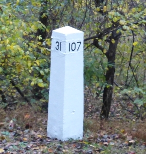
In Maryland there are white mileage posts with 2 faces. For the Northbound traveler, the mileage will show the number of miles to Sunbury, Pennsylvania. For the Southbound traveler, the mileage will show the number of miles to Baltimore Maryland. A white mileage post just South of the Bentley Springs MDparking lot, indicates 107/31 or 107 miles to Sunbury and 31 miles to Baltimore. Bently Springs is 6 miles north of Hereford MD
In my travels along the trail (in Maryland), I have noticed most of the white markers follow the above format. In Pennsylvania many of the markers are 2 faced. The Northbound face to Sunbury has no mileage. It is blank. On a recent walk near Hanover Junction there was one white post with the number 46. It was single sided facing the trail!
In Maryland, there is a separate set of mileage markers that starts at 0 in Ashland and ends at 19, about 8/10 of a mile shy of the Mason Dixon line (the dividing line between MD and PA).
In Pennsylvania, a separate set of mileage posts, start at 0 at the Mason Dixon and work there way up as one travels North.
Calverton NY (Long Island)
Picture by Nick Kudrako
Central MA
Cuyahoga Valley Scenic RR, Ohio
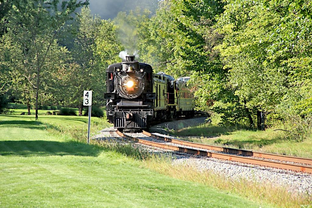
Steamer #1293 passes milepost 43, which is measured from Mineral City, Ohio, as it chugs into Akron on the point of the second excursion train of the day. Photo by Craig Sanders and was found here.
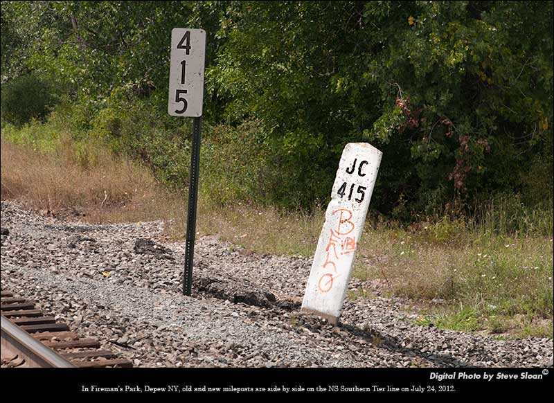
Depew NY
In Fireman's Park in Depew, on the NS Southern Tier Line is the JC 415 Milepost. Right next to it is the new NS milepost.
According to Otto Vondrak, "Measuring back to the old Erie Railroad terminal in Jersey City, NJ!" Found here.
Elkridge MD
This beautiful milepost used to be in Elkridge, at the split between the Old Main Line and the Washington Branch of the B&O - just a few hundred feetaway from the Elkridge MARC station, and was from the very early days of the railroad. It disappeared sometime around 2000 or so, and it's either in someone's back yard or hidden away at the B&O Railroad museum.
Photo Copyright Intersystem Concepts, Inc. Used with permission. See http://www.trainweb.org/oldmainline or more specifically: http://www.trainweb.org/oldmainline/was1.htm#mile_markers
Farmville VA
Along the former Richmond, Fredericksburg, and Potomac RR tracks, now the CSX main between Richmond VA and Washington DC.
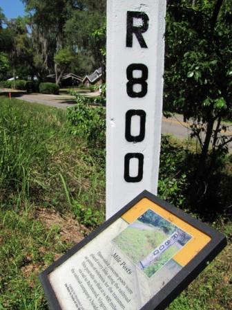
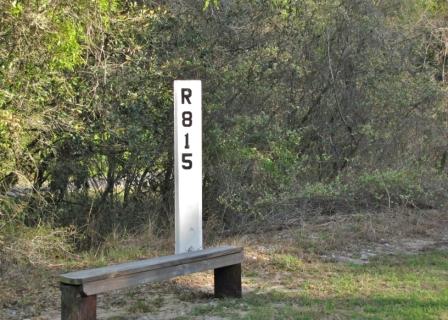
Floral City FL
Former Seaboard Airline RR mileposts 800, 815, and 794. Photos by Cosmos Mariner, and found at: https://www.hmdb.org/m.asp?m=125492.

Haverhill MA
This Milepost is along the Bradford Rail Trail, located on the southern bank of the Merrimack River in Haverhill. On this side, the "B" stands for Bradford, so this milepost is in Bradford. On the other side which we can't see, it says "G6", or six miles to Georgetown.
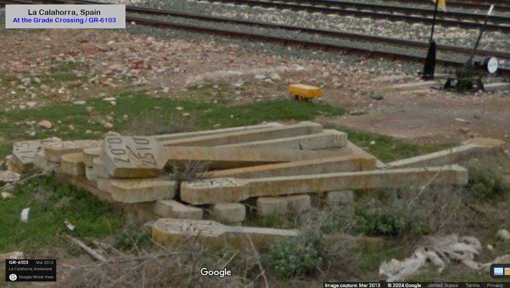
La Calahorra Spain
Don't know if these are mileposts (kilometer posts :-) or not, but nevertheless, they look like one.
From my page: https://railfanguides.us/spain/lacalahorra/
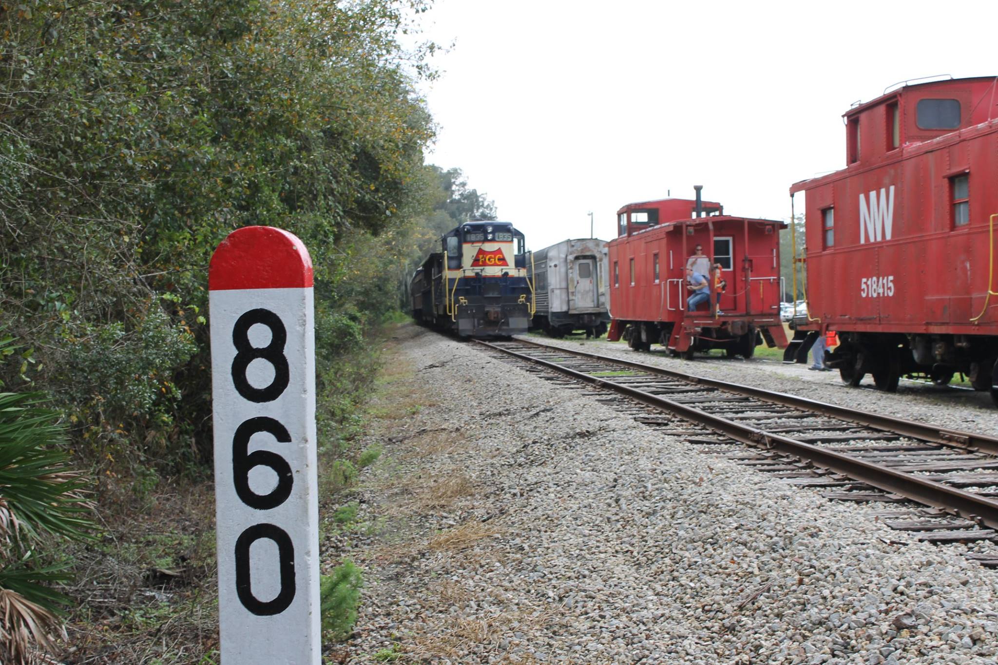
Parrish FL
Milepost on the Seaboard Coast Line at the Florida Railway Museum, miles are to their HQ in Richmond VA.
Anyone have a better full length picture?
Florida Railroad Museum, 12210 83rd St E, Parrish FL 34219
https://www.facebook.com/frrm.org
Picayuni MS
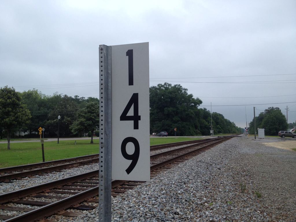
At the Amtrak station in Picayuni.
https://www.facebook.com/milepost149/
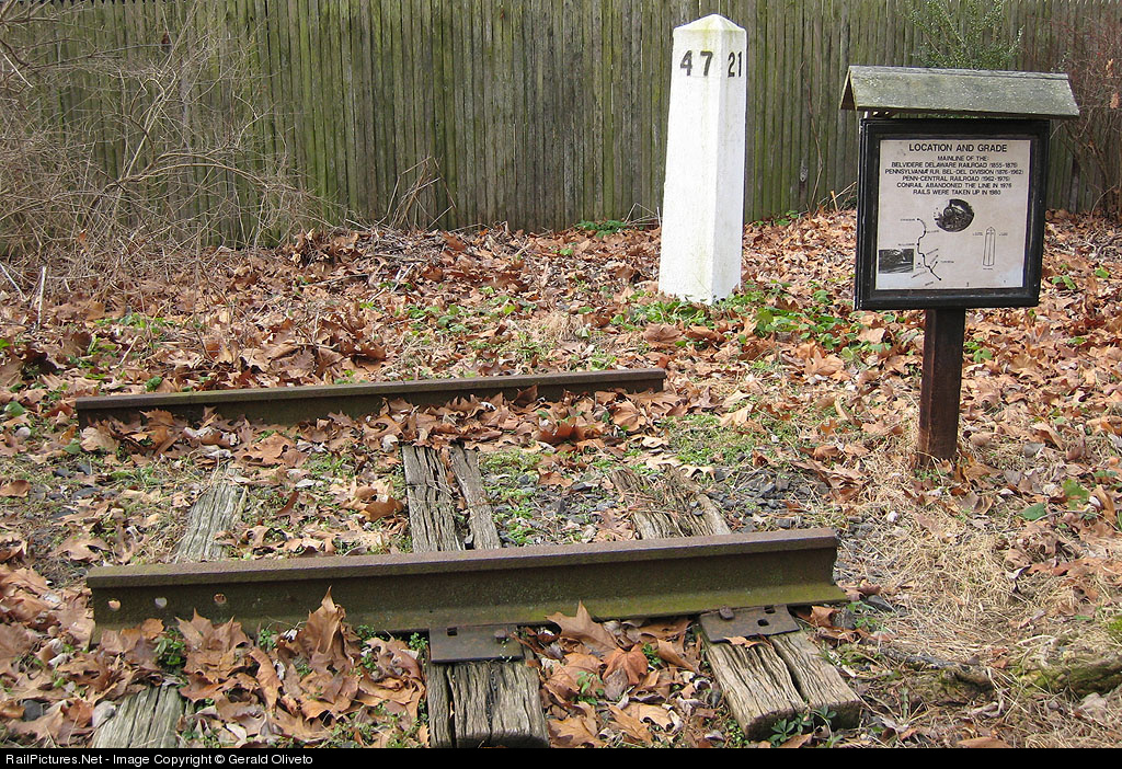
Stockton NJ
A display set up in town, photo by Gerald Oliveto, found in Google Images:
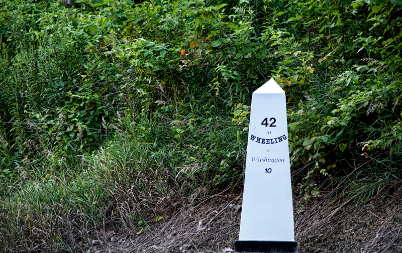
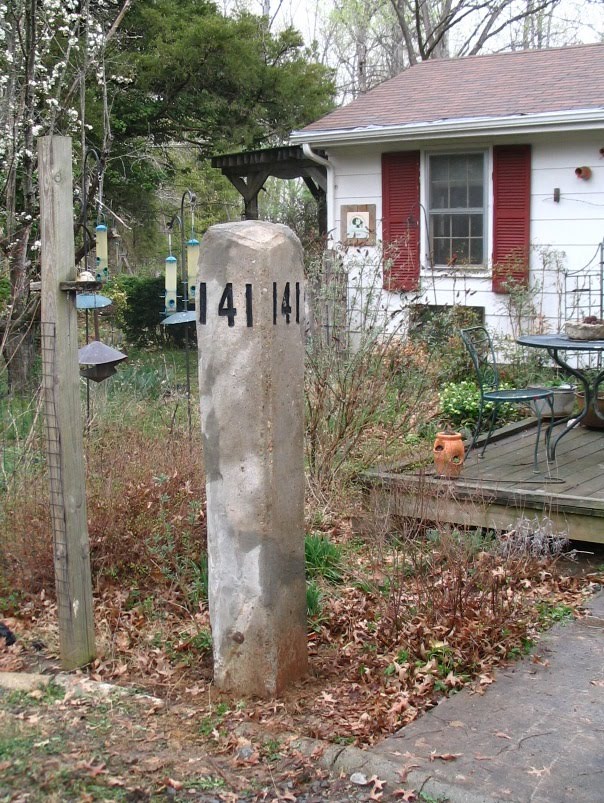
Washington PA
A picture of a nice milepost east of Washington along I-70 (old Route 40), by Rich McPeek, found at: http://www.richmcpeek.com/2013/08/05/historic-national-road-route-40/ (sorry, link no longer works).
Virginian Rwy Milepost?
Not sure if it is a Virginian milepost or not, but the picture name suggested that.
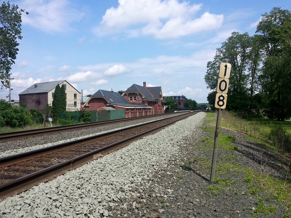
Westfield, MA
At the train station - June/2014 - photo by Ryan Cowles, found here.
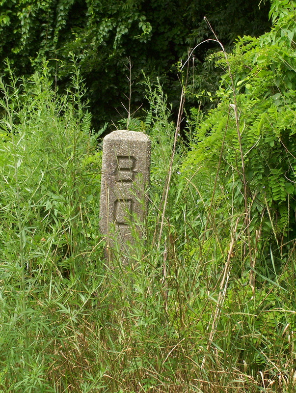
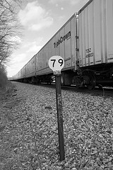
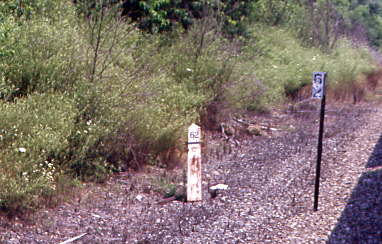
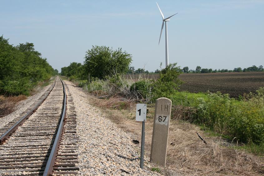
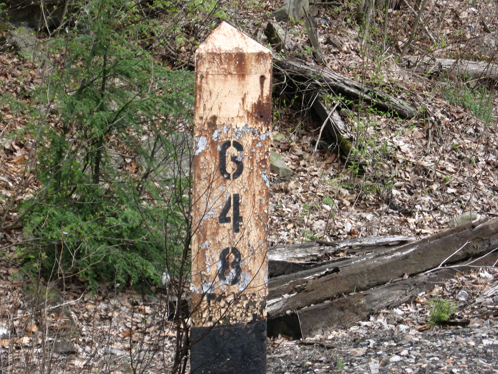
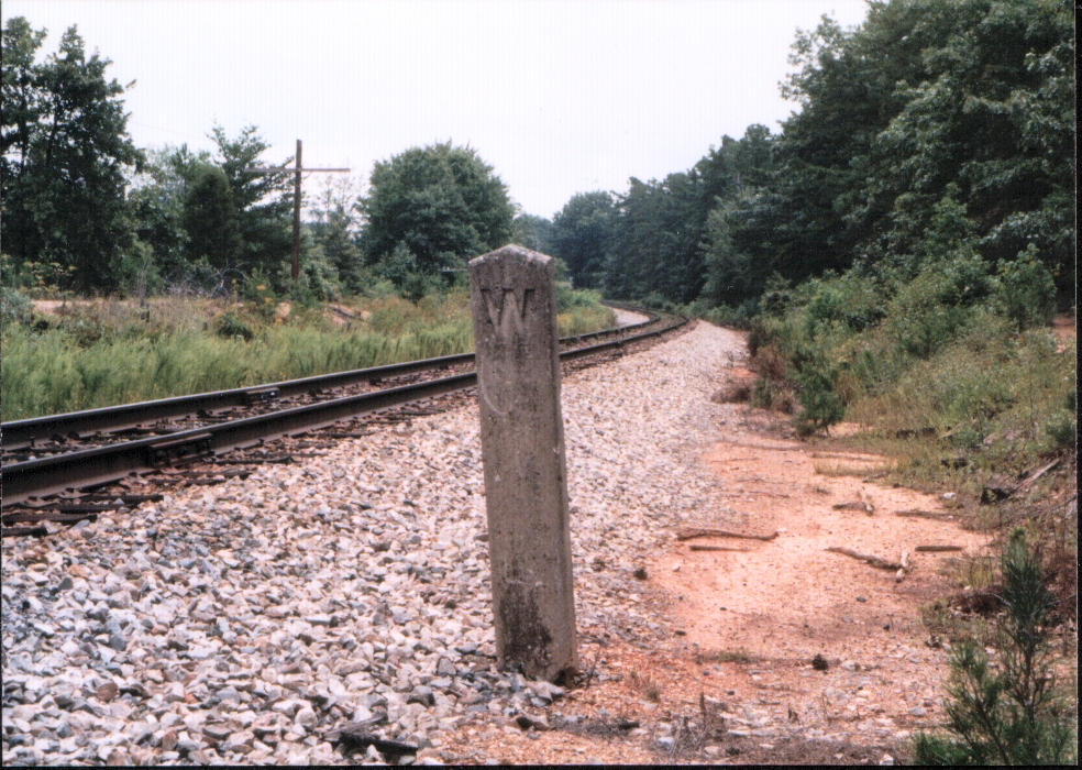
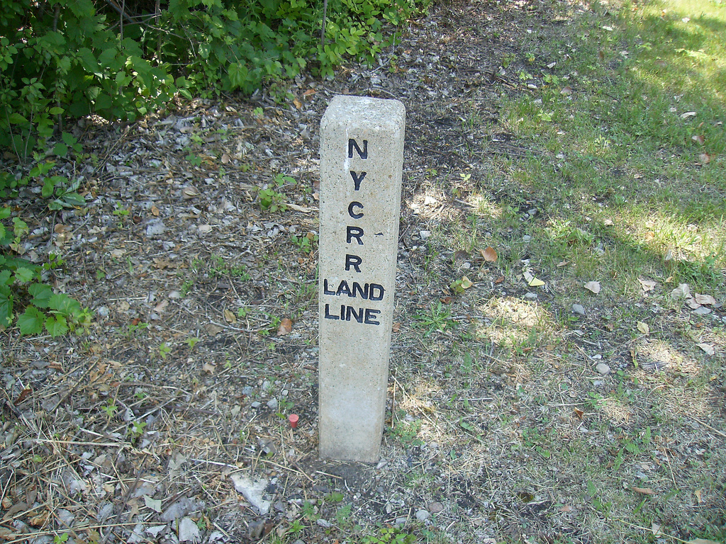
Unknown Locations :-(
Disclaimers:
New format 10/26/23: Please check out my disclaimer page for my standard dribble and contact info here
RAILFAN GUIDES HOME
RAILROAD SIGNALS HOME
NEW 07/04/2015, AUG02/2015, APR01/04/2024
Last Modified 04-Apr-2024