BALTIMORE RAILFAN GUIDE
RAILFAN GUIDES HOME
RAILROAD SIGNALS HOME

In General


Location / Name:
East Baltimore MD

What's Here:
CSX/NS Diamond
CSX/Canton RR Penn-Mary Yard
NS Canton Yard

Data:
GPS Coordinates: 39.266050, -76.553991
Phone A/C: 410
ZIP: 21224

Access by train/transit:
MTA NV Bus Line comes the closest, about 1/4 mile away


The Scoop:

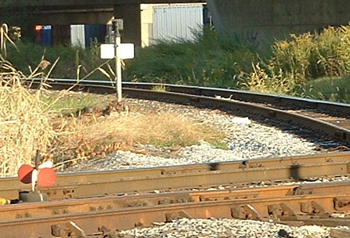
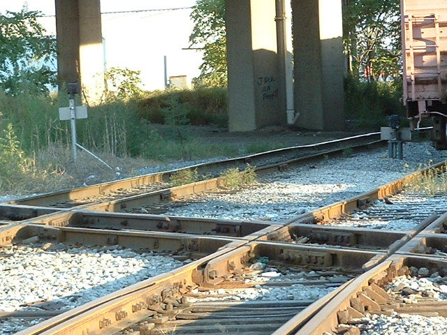
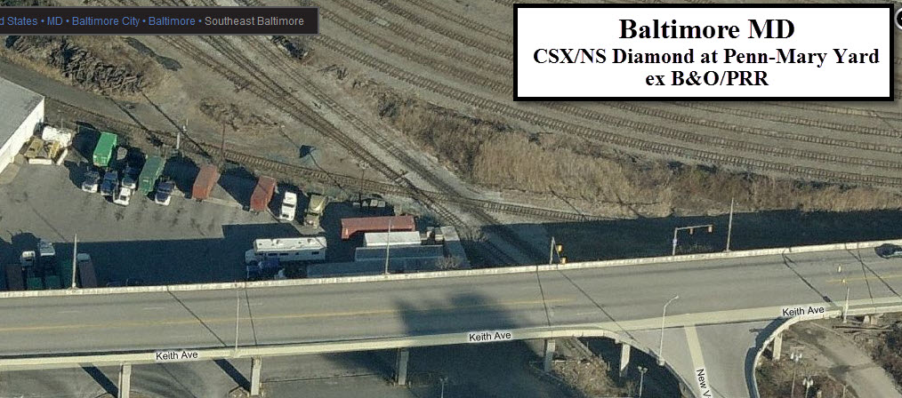
Here in East Baltimore is a small, slow speed diamond crossing between what used to be the B&O and the Pennsy.  Today it is between CSX and NS.  Since the General Motors Chevy plant closed (and subsequently torn down) years ago, there is not much NS traffic going thru here. 

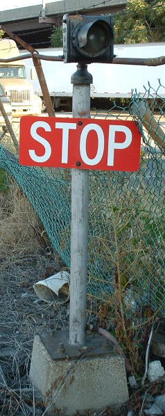
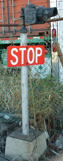
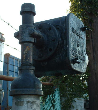
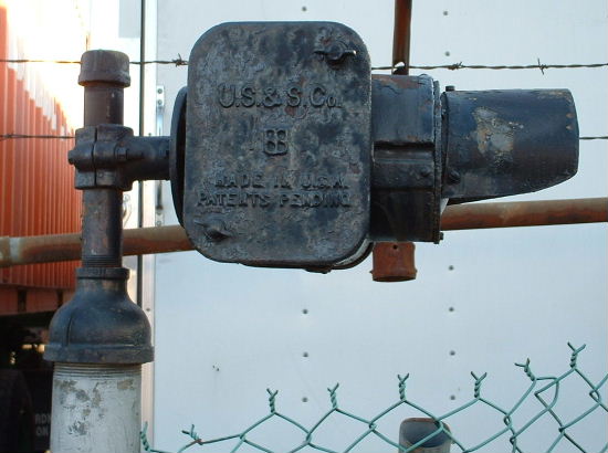
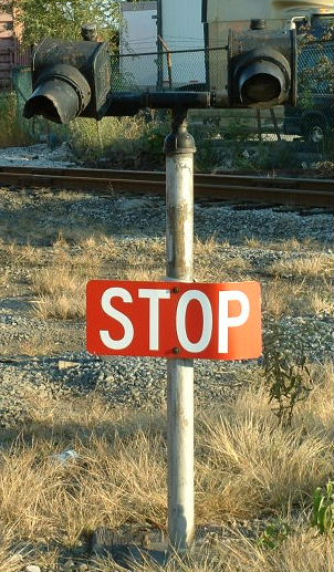
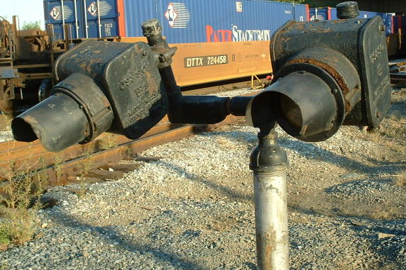
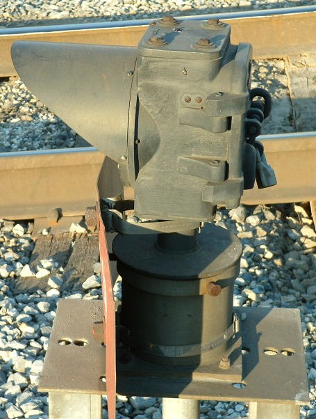
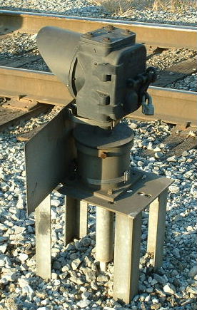
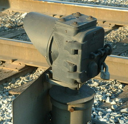
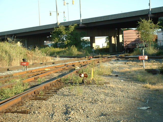
The signal heads are all Pennsy PL-3 type signal heads, mounted in a dwarf configuration on custom made mountings as can be seen below.  The newer head was/is probably a replacement.  None of the lights are lit, as the plastic conduit is in terrible condition, and broken in many places on the long runs.

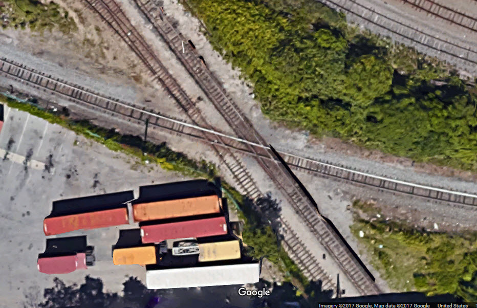
The photos below were taken in 2005, and are from a diamond at the south end of Penn-Mary Yard in east Baltimore (Google Earth picture at bottom of the page).

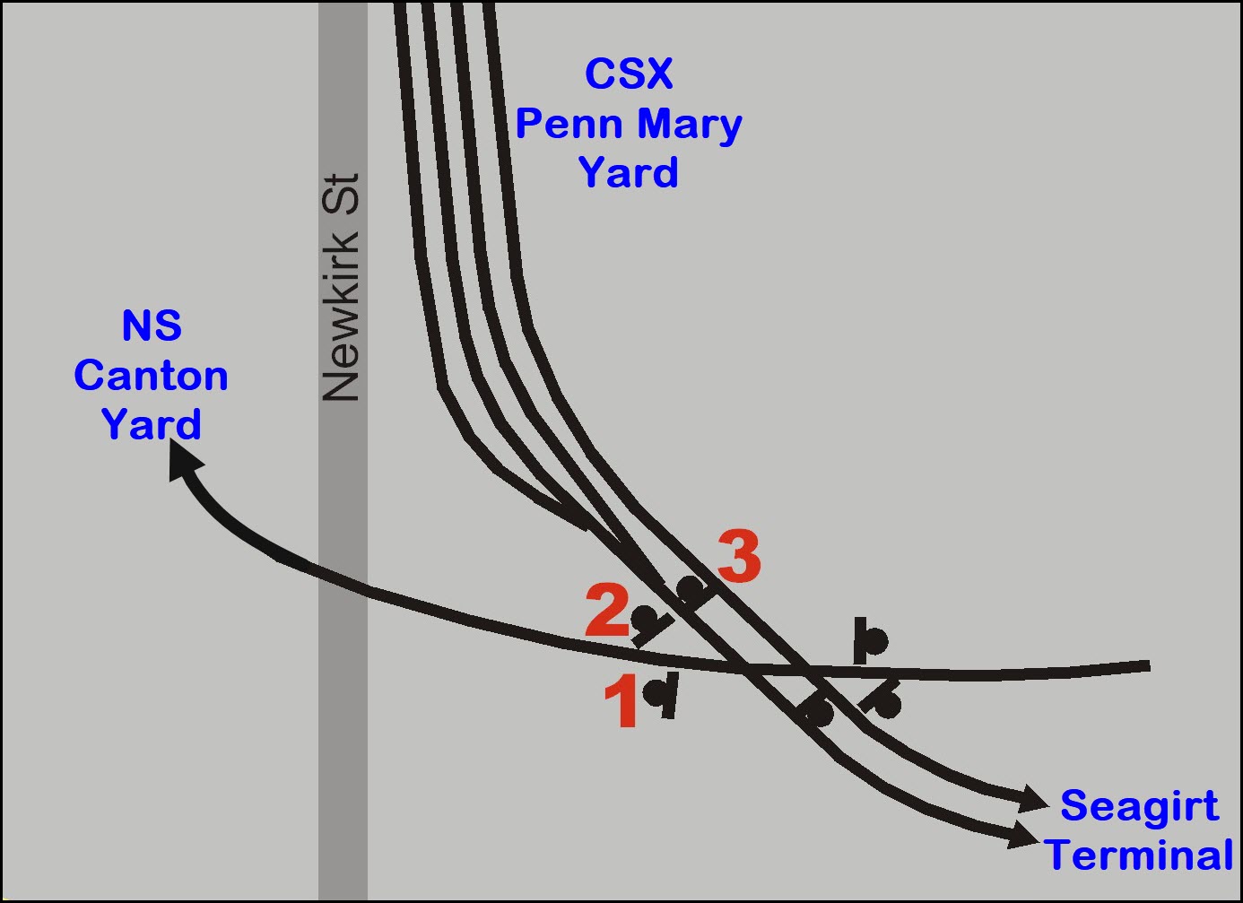
The crossing is between a tail track which comes off of the former PRR/Conrail, now NS Canton Yard that crosses the CSX "below" Penn-Mary Yard.

Thanks to Michael Watnoski for turning me on to these signals, I've lived in Baltimore since 1966 and didn't know about these until 2005.

This diamond also appears on MAP10 of my Baltimore Railfan Guide, altho the details are on this page.


Acknowledgements:
Michael Watnoski
Denver Todd

Websites and other additional information sources of interest for the area:
None yet


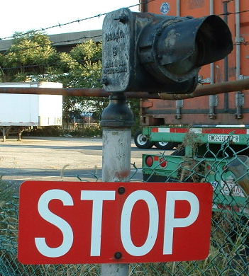
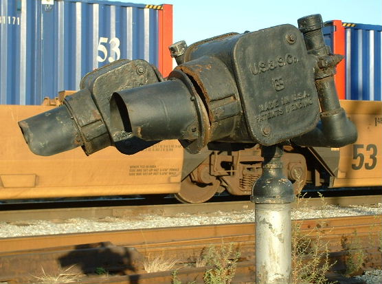
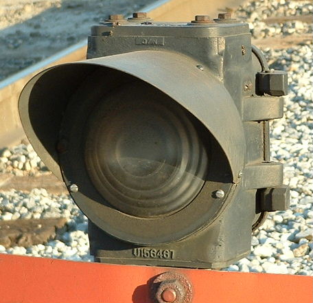
  The first set is a single unit signal, sitting on top of a 3" pipe, about 5 feet high.  Judging from the wiring leading up to the signal, which is (was) in plastic conduit, I don't think the lights work anymore.  We didn't see any of them lit.  This signal uses a standard US&S PL-3 head, the kind that shows up on Pennsy and N&W PL signals.  The last picture is a similar signal on the far side of the diamond.


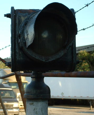
  This signal, a double set of the US&S heads, protects CSX freights crossing the diamond.  Just prior to the diamond, two tracks come together, that is the only reason we could see for the double light.  Again, since these things are pretty much aimed at the ground, I don't believe they light up any more.  In the middle shot, you can see how things are rusting apart and the lens is ready to fall out.


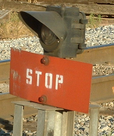
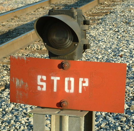
  The following signal guards a single CSX track at the diamond.  It is a US&S single aspect color light head.


Here are a few shots of the other signals and the whole diamond.

The top shot shows the two sets of CSX signals on the far side of the diamond. 


The middle picture shows the two close CSX signals and the diamond.


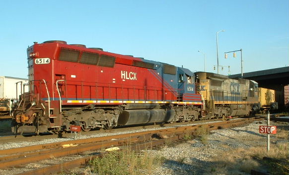
The shot below is a CSX freight that was working the Seagirt Marine Terminal.


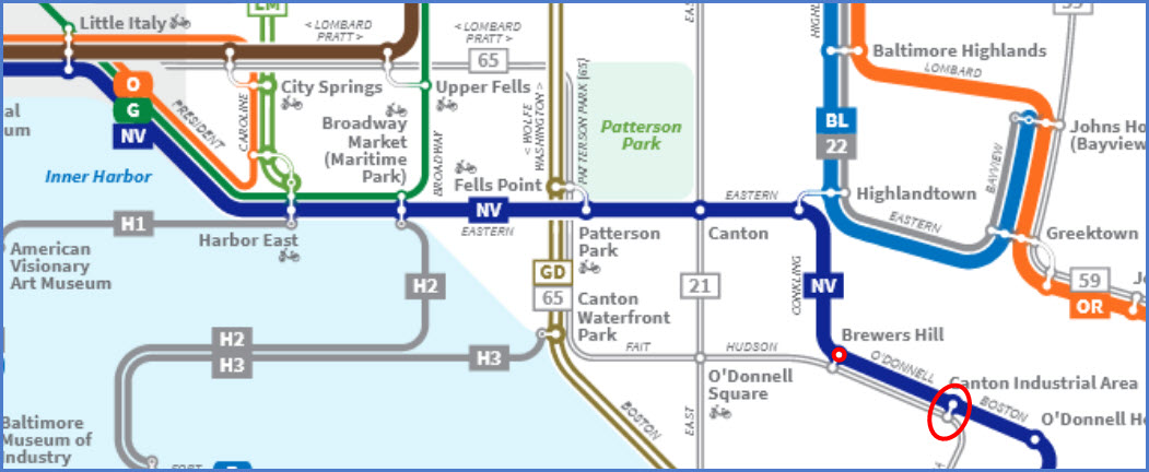
The above shot is from Bing Maps and below is a Google Maps aerial picture of the diamond area.
Screen shots captured using Techsmith's Snagit.


Disclaimers:

I love trains, and I love signals.  I am not an expert.  My webpages reflect what I find on the topic of the page.  This is something I have fun with while trying to help others. 

Please Note:
 Since the main focus of my two websites is railroad signals, the railfan guides are oriented towards the signal fan being able to locate them.  For those of you into the modeling aspect of our hobby, my indexa page has a list of almost everything railroad oriented I can think of to provide you with at least a few pictures to help you detail your pike.

If this is a railfan page, every effort has been made to make sure that the information contained on this map and in this railfan guide is correct.  Once in a while, an error may creep in :-)  

My philosophy: Pictures and maps are worth a thousand words, especially for railfanning.  Text descriptions only get you so far, especially if you get lost or disoriented.  Take along good maps.... a GPS is OK to get somewhere, but maps are still better if you get lost!  I belong to AAA, which allows you to get local maps for free when you visit the local branches.  ADC puts out a nice series of county maps for the Washington DC area, but their state maps do not have the railroads on them.  If you can find em, I like the National Geographic map book of the U.S..... good, clear, and concise graphics, and they do a really good job of showing you where tourist type attractions are, although they too lack the railroads.  Other notes about specific areas will show up on that page if known.

By the way, floobydust is a term I picked up 30-40 years ago from a National Semiconductor data book, and means miscellaneous and/or other stuff.

Pictures and additional information is always needed if anyone feels inclined to take 'em, send 'em, and share 'em, or if you have something to add or correct.... credit is always given! BE NICE!!! Contact info is here

Beware: If used as a source, ANYTHING from Wikipedia must be treated as being possibly being inaccurate, wrong, or not true.

RAILFAN GUIDES HOME
RAILROAD SIGNALS HOME


web statistics

New: 1-14-2007, 7-5-2015
Mod: 20-Nov-2017